
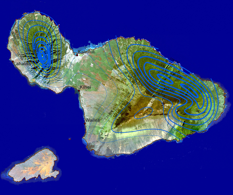
The isolines on this map of the island of Maui in Hawaii are used to show the distribution of rainfall. The map demonstrates how dramatically different the amount of rainfall can be for very small area. The closer the lines and darker shade of green signify the areas with the most rainfall. http://www.esri.com/news/arcwatch/0207/graphics/feature1-lg.jpg
No comments:
Post a Comment