skip to main | skip to sidebar

My Map Catalog

Tuesday, December 2, 2008

DEM

A digital elevation model is a digital representation of ground surface, topography or terrain. It can be represented as a raster or as triangular. This map from NOAA is a raster map that shows the topography of the United States East coast.
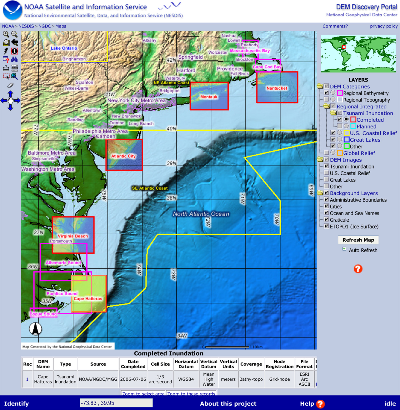
http://www.ngdc.noaa.gov/mgg/image/demportal.jpg
Posted by Parker at 5:41 AM

No comments:

Post a Comment

Newer Post Older Post Home
Subscribe to: Post Comments (Atom)

Blog Archive

  • ▼  2008 (54)
    • ▼  December (31)
      • Correlation Matrix
      • Similarity Matrix
      • Star Plots
      • Stem and Leaf Plot
      • Box Plot
      • Histogram
      • Parallel Coordinate Graph
      • Triangular Plot
      • Windrose
      • Climograph
      • Population Profle
      • Scatterplot
      • Index Value Plot
      • Lorenz Curve
      • Bilateral Graph
      • Nominal Area Choropleth Map
      • Unstandardized Choropleth Maps
      • Standardized Choropleth Map
      • Univariate Choropleth Map
      • Bivariate Choropleth Map
      • Unclassed Choropleth Map
      • Classed Choropleth Map
      • Range Graded Proportional Circle Map
      • Continuously Variable Proportional Circle Map
      • DOQQ
      • DEM
      • DLG
      • DRG
      • Isopleth
      • Isopach
      • Isohyets
    • ►  November (2)
    • ►  October (16)
    • ►  September (5)

About Me

Parker
View my complete profile